Classifications
azimuthal
equidistant
Graticule
Polar aspect:.
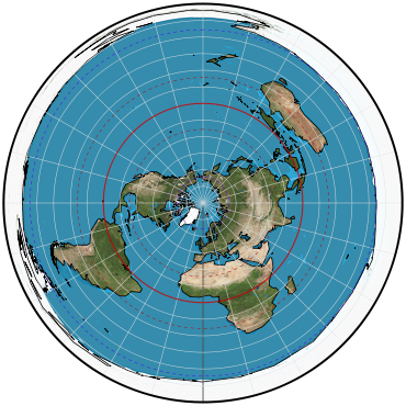
Meridians: Equally spaced straight lines intersecting at the central pole. Angles between them are the true angles.
Parallels: Equally spaced circles, centered at the pole, which is a point. The entire Earth can be shown, but the opposite pole is a bounding circle having a radius twice that of the equator.
Symmetry: About any meridian.
Equatorial aspect:.
Meridians: Central meridian is a straight line. Meridian 90° away is a circle. Other meridians are complex curves, equally spaced along the equator and intersecting at each pole.
Parallels: Equator is a straight line. Other parallels are complex curves concave toward the nearest pole and equally spaced along the central meridian and the meridian 90° from the central meridian.
Symmetry: About the central meridian or the equator.
Oblique aspect:.
Meridians: Central meridian is a straight line. Other meridians are complex curves intersecting at each pole.
Parallels: Complex curves equally spaced along the central meridian.
Symmetry: About the central meridian.
Scale
True along any straight line radiating from the center of projection. Increases in a direction perpendicular to the radius as the distance from the center increases.
Distortion
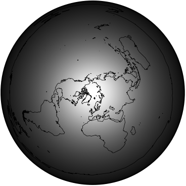
Only the center is free from distortion. Distortion is moderate for one hemisphere but becomes extreme for a map of the entire Earth.
Special features
The distance between any two points on a straight line passing through the center of projection is shown at true scale; this feature is especially useful if one point is the center. Compromise in distortion between Stereographic (conformal) and Lambert azimuthal equal-area projections.
Usage
Commonly used in the polar aspect for maps of polar regions, the Northern and Southern Hemispheres, and the "aviation-age" Earth. The oblique aspect is frequently used for world maps centered on important cities and occasionally for maps of continents. The ellipsoidal form is used for topographic mapping of Micronesia and Guam.
Similar projections
Two-Point azimuthal shows correct azimuths (but not distances) from either of two points to any other point.
Two-Point equidistant shows correct distances (but not azimuths) from either of two points to any other point.
Chamberlin Trimetric shows approximately true distances from three chosen points to any other points (cannot be exact). The three points are placed near the edges of the region being mapped to reduce overall distortion.
Airy and Breusing azimuthal projections have spacings very similar to those of the azimuthal equidistant if the extent is less than one hemisphere.
Berghaus Star projection uses the polar azimuthal equidistant projection for the Northern Hemisphere.
“Tetrahedral” projection combines the polar azimuthal equidistant projection with an interrupted Werner projection.
Origin
Possibly developed in the polar aspect by Egyptians for star charts. Several users during the 16th century.
Description adapted from J.P. Snyder and P.M. Voxland, An Album of Map Projections, U.S. Geological Survey Professional Paper 1453. United States Government Printing Office: 1989.
 Cylindric
 Pseudocylindric
 Conic
Conic Azimuthal
 Lenticular
 Miscellaneous

